For the second time in 2 years I’m working at a wind farm with a potential karst problem.
If you’re reading this post you are probably aware of what is karst – basically, the result of dissolution of rocks such as limestone and gypsum, that can produce beautiful landscaping results (such as caves, sinkholes and dolines) but also several problems for the foundations of structures.
If the size of the cavities is reduced (a couple of centimetres) the will not be a problem because the foundation will not notice them. However in unlucky cases, you can dig and open the foundation and discover a huge hole that can be several cubic meters big.
I’ve heard stories of civil subcontractors who pumped the load of several concrete mixers in the holes without filling them (in some cases you can find a network of connected cavities).
Relocation of the WTG is a solution, but is usually not the best due to several reasons (maybe the adjacent land plot is not available, or you have a tight layout with very close turbines, or there are environmental constraints).
Also, it’s usually not free: depending on your contract, the civil subcontractor could be entitled to ask for a variation order.
Which are the available technical solution?
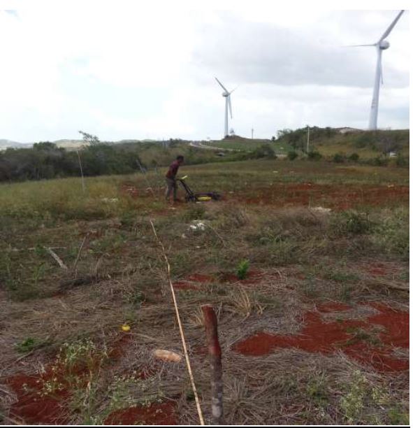
As far I’m aware of, MASW, electrical tomography and ground penetrating radar (GPR). I’ve used the last one successfully in a project in Jamaica and it worked well.
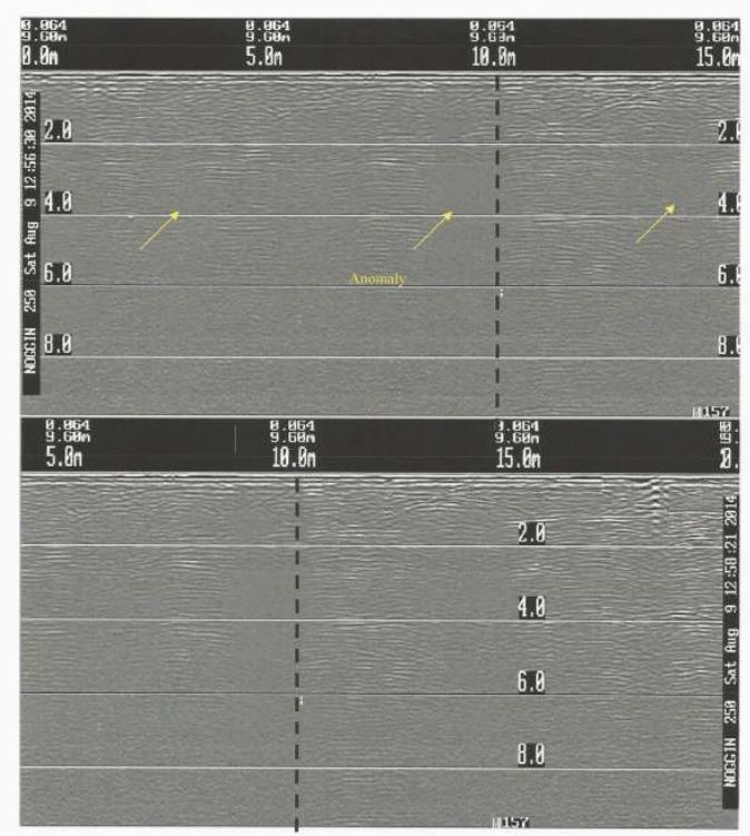
Basically, the GPR investigation is a non-invasive technique that can detect anomalies (locations, depth and approximate size of cavities) and spot any inconsistency or variation in the expect soil profile across each site.
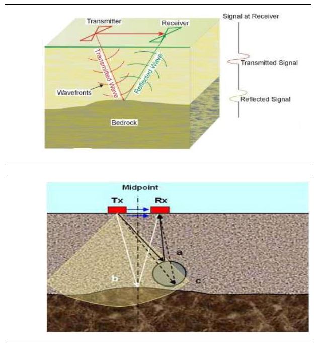
Resuming shortly how it works, GPR generate and send electromagnetic waves into the surface with an antenna, moving along the inspected surface.
Whenever a radar pulse strikes a boundary interface of contrasting dielectric (basically, between different materials), a portion of the pulse is reflected back to the surface to a receiving antenna.
The contrast in properties between clay (the weathered material which usually fills the holes) and limestone help to identify zones of subsidence. Conversely, a lack of contrast indicates relatively uniform stratigraphy.
Subsurface profiles will be generated displaying the resulting echoes of individual pulses.
Integrating this technique with standard boreholes will decrease the geotechnical risk of your project.
Leave a Reply